
How LiDAR Mapping Helps Record Complex Urban Properties
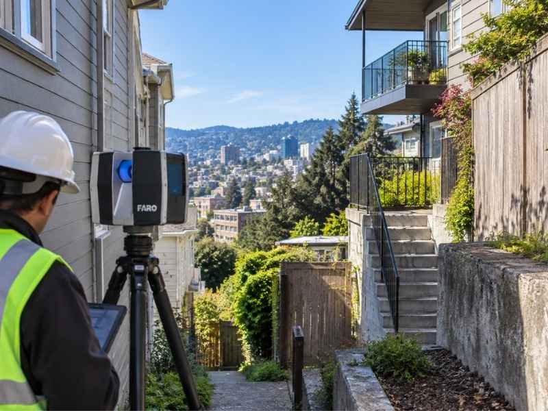
Older neighborhoods were not built with neat, open lots. Buildings sit close together. The ground rises and falls block by block. Many lots have structures from different decades crammed onto one small piece of land.
Recording these sites the right way takes more than a tape measure and a few marks on the ground. This is where LiDAR mapping helps.
LiDAR mapping uses laser pulses to scan a site. It builds a detailed map made of thousands of data points. Instead of measuring just a few spots, it captures the whole surface of a property.
If you are buying, building on, or getting permits for a tight city lot, this tool can catch problems early. That means fewer delays and fewer disputes later.
Why Dense Urban Sites Are Difficult to Document
City lots pack a lot into a small space. Setbacks are tight. Fences often sit where they should not. Underground pipes and wires do not always match old records.
Survey crews using regular tools can lose sight lines. A building, a parked car, or thick bushes can block the view. A blocked view means a missed measurement. A missed measurement means gaps in the final map.
Some common problems on dense lots include:
- Buildings built too close to or across the setback line
- Shared walls between homes with unclear ownership
- Older additions that were never properly surveyed
- Pipes and wires moved over time without updated records
LiDAR mapping helps fix these gaps. It scans from many angles. This means even hard-to-reach spots get recorded.
Capturing Elevation Changes Across Multi-Level Urban Properties
Oakland has real hills. Even the flatter parts of town often have retaining walls, split driveways, or lots that step down in stages. A yard that looks flat from the street can actually change height several times.
LiDAR mapping records height changes across the whole site, not just at a few points. This gives a true picture of how the land rises, drops, and steps between levels.
This detail matters for a few reasons. Drainage plans need to know exactly where water will flow. Grading work needs real numbers, not guesses. Building on a sloped lot needs exact height differences between structures.
Why Elevation Accuracy Affects Permitting
Cities often check grading and drainage plans closely before they approve permits. Missing height data is a common reason permits get delayed. If your project includes regrading, retaining walls, or new drainage, ask early if your survey covers full elevation data.
Recording Features Around Buildings, Walls, and Tight Access Areas
Narrow side yards, shared driveways, and space behind fences are some of the hardest spots to measure by hand. On many lots, these tight areas are exactly where boundary questions come up.
LiDAR mapping scans from several angles. This fills in details that would normally require squeezing into cramped spaces. It usually covers:
- Narrow gaps between buildings next to each other
- Space behind walls, fences, or retaining structures
- Roof edges and other upper parts of buildings
- Shared alleys or access paths
On older properties, this can reveal things nobody knew about. A wall might lean a little. A building might sit closer to the line than the deed says. Finding this early gives you time to fix it before it affects a sale, a permit, or a neighbor.
Connecting LiDAR Data With Survey Control and Property Records
A LiDAR scan creates a huge amount of data. But data points alone do not create a legal property record. That data must connect to survey control, which means fixed and checked reference points on the ground.
A licensed surveyor links the scan data to those control points. They also connect it to recorded deeds, plats, and easement papers. This step turns raw data into something you can actually use for design, permits, or a real estate deal.
Skip this step and you are left with a detailed picture that does not clearly match your legal boundaries. That can become a real problem if a dispute or title question comes up later.
Rules for confirming boundaries can be different depending on the county, city, lender, or title company. Ask your surveyor what your project actually needs.
Using Detailed Site Records for Redevelopment and Due Diligence
Redevelopment projects run smoother when everyone works from the same accurate map. Architects, engineers, and contractors all use the same base survey. Small errors early on tend to grow bigger as the project moves forward.
LiDAR mapping gives development teams that solid starting point. It also gives buyers, lenders, and title companies a clearer view of a property before closing.
Common uses include:
- Checking existing site conditions before design starts
- Supporting ALTA surveys for commercial real estate deals
- Spotting encroachments or setback problems early
- Recording structures before renovation or demolition
keeps seeing a lot of infill building and property turnover. Accurate, well-documented site data lowers risk for buyers, sellers, and everyone in between.
If your closing, permit, or construction schedule depends on survey results, bring in your surveyor early. Complex city sites usually need more planning time than open land.
Frequently Asked Questions
What does LiDAR mapping actually measure?
It measures the physical surface of a property. This includes ground height, buildings, walls, and other visible features. It does this by capturing thousands of precise data points across the site.
Can LiDAR mapping replace a legal boundary survey?
No. LiDAR captures physical conditions. Setting a legal boundary still needs a licensed surveyor to connect that data to recorded deeds and checked survey control.
How long does a LiDAR mapping project take on a tight city lot?
It depends on the site’s size, how hard it is to access, and how much detail is needed. Tight access can affect scheduling even though the scan itself moves fast.
