Your Final Stop for ALL of Your Survey Needs! Contact us today for a free quote!
This site is intended to provide you with information on Land Surveying in the Oakland, CA and Alameda County area of California. If you’re looking for a Oakland Land Surveyor, you’ve come to the right place. If you’d rather talk to someone about your land surveying needs, please call our local number at (510) 804 0770 today. For more information, please continue to read.
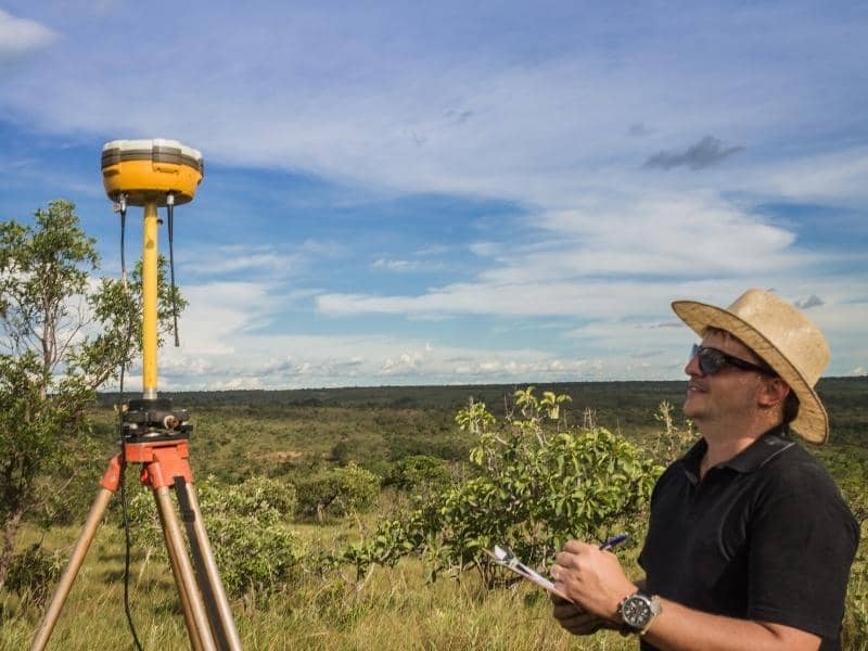
Land Surveyors are professionals who make precise measurements to determine the size and boundaries of a piece of real estate. While this is a simplistic definition, boundary surveying is one of the most common types of surveying related to home and land owners. If you fall into the following categories, please click on the appropriate link for more information on that subject:
Oakland Land Surveying services:
I need to know where my property corners or property lines are. (Boundary Survey)
I have a loan closing or re-finance coming up on my home in a subdivision. (Lot Survey)
I need a map of my property with contour lines to show elevation differences for my architect or engineer. (Topo Survey)
I’ve just been told I’m in a flood zone or I’ve been told I need an elevation certificate in order to obtain flood insurance or prove I don’t need it. (Flood Survey)
I’m purchasing a lot/house in a recorded subdivision. (Lot Survey – See Boundary Survey if you’re not in a subdivision.)
I’m purchasing a larger tract of land, acreage, that hasn’t been subdivided in the past. (Boundary Survey)
Contact Oakland Land Surveying services TODAY at (510) 804 0770.
Some properties carry more history than others. Sites near ports, rail lines, and distribution centers have been working properties for a long time, and that work leaves marks. Paved yards that served a shipping operation twenty years ago are still there. Access lanes built for freight trucks don’t just disappear when the original tenant moves out. Buyers who walk one of these sites for the first time are really walking through several different eras of use at once, and sorting out what that means for their plans takes more than a basic walkthrough. An ALTA survey gives buyers a clear documented picture of what the site actually holds before any serious decisions get made.
Why Port-Influenced Properties Often Reflect Generations of Transportation Changes
Freight patterns change over time. Rail dominated for decades, then trucking took over large portions of that volume, then intermodal shipping changed the picture again. Properties near ports and rail corridors adapted to each of those shifts, and the physical evidence of those adaptations tends to stick around long after the industry moved on.
A site that started as a rail-served warehouse might have added truck docks in the 1970s, expanded its paved yard in the 1990s, and gone through two or three ownership changes since then. Each phase added something to the site, and not all of it got removed when the next owner arrived. An ALTA survey records what exists on the ground today, pulling together the full picture of what those years of change left behind. For a buyer trying to figure out what they’re actually purchasing, that documented record is a much more reliable starting point than a property listing or a conversation with the current owner.
How Former Loading Areas and Service Yards Continue to Shape Modern Property Layouts
Heavy paving doesn’t go away on its own. Concrete yards built to handle forklifts and loaded trailers can last for decades, and they tend to define how a site gets used long after the original operation is gone. The same goes for service lanes, staging areas, weigh stations, and covered loading bays. These features were built to handle serious industrial activity, which means they were built to last.
When a buyer looks at a site like this, those old improvements are still shaping what’s possible. A large paved yard that takes up half the property affects where new buildings can go, how drainage needs to be managed, and what demolition costs might look like if the buyer wants to change the layout. An ALTA survey documents all of those existing improvements with enough detail that the project team can make real decisions about what to keep, what to work around, and what to budget for removing.
Why Access Patterns Created for Trucks and Freight Traffic Still Matter to New Owners
Industrial sites were built around movement. Trucks needed room to turn. Trailers needed space to back into docks. Circulation paths were wide and direct because slowing down freight cost money. That design logic produced access patterns that look very different from what a retail center or office park would have.
Those patterns don’t automatically fit a new use just because the site changed hands. A buyer planning a different kind of operation needs to know where the current entrances sit, how the drive aisles run through the property, and whether the existing circulation setup works for their needs or creates problems. An ALTA survey maps out those access conditions clearly. Some buyers find the existing truck-scale access is actually useful for their plans. Others find it needs significant changes. Either way, knowing what’s there before design work starts saves time and money compared to finding out mid-project.
How an ALTA Survey Helps Buyers Evaluate Properties That Grew in Stages Over Time
Industrial properties rarely got built all at once. A core building went up first, then a warehouse addition came later, then a detached shop building appeared, then a fuel island, then more paving. Each expansion made sense at the time, but the result is a property that reflects multiple different decisions made across multiple different decades by multiple different owners.
Trying to understand a site like that from the outside is difficult. The improvements don’t always look connected because they weren’t planned as a single project. Here’s what tends to accumulate on industrial properties that grew in stages over time:
Buildings and additions constructed during different periods with different materials and standards
Paved areas that expanded gradually without a unified grading or drainage plan
Utility connections added at different points that may not all be clearly documented
Fencing, gates, and security features installed by different owners for different reasons
An ALTA survey brings all of that together into one current record. Buyers get a complete snapshot of what the property holds today instead of trying to piece together the history from incomplete files and old drawings.
Why Understanding the Surrounding Infrastructure Is Just as Important as Understanding the Site
An industrial property doesn’t exist by itself. What sits around it matters just as much as what’s on it. A rail spur running along the back edge of the property affects how the site can be used and what it might be worth to certain buyers. A port facility nearby creates both opportunity and constraints depending on what the new owner has in mind. Warehouse and distribution centers clustered in the same area shape traffic patterns, zoning expectations, and long-term land values.
An ALTA survey documents the site itself, but it also captures how that site connects to what’s around it. Access points that tie into shared roads or rail crossings show up in the survey. Features along the property boundary that relate to neighboring port or industrial operations get recorded. For a buyer evaluating whether a site fits their plans, that surrounding context is part of the answer. A property that looks limited on its own might make a lot more sense once the buyer understands how it sits within a larger industrial area, and an ALTA survey helps provide that broader picture.
Frequently Asked Questions
Why are port and industrial properties different from other commercial sites?
They tend to hold decades worth of improvements tied to freight, shipping, and industrial operations that changed over time, leaving behind a mix of features that other property types don’t typically have.
What does an ALTA survey show on an industrial property?
It records existing improvements, access conditions, and physical site features that help buyers understand what they’re purchasing before plans are drawn or money is committed.
Can an ALTA survey help evaluate older freight and warehouse sites?
Yes. It captures current site conditions in enough detail that buyers and their teams can assess what’s there, what it affects, and what it means for future plans.
Who typically orders an ALTA survey for industrial properties?
Buyers, developers, lenders, attorneys, title companies, and investors all request ALTA surveys when industrial properties change hands or move toward redevelopment.
Does an ALTA survey only focus on buildings?
No. It covers the full property, including access patterns, paved areas, surrounding features, and other improvements that affect how the site functions and what it can support going forward.
A fence in the wrong spot. A shed that crosses the property line. A tree with branches hanging over your yard. Property line disputes are some of the most stressful issues homeowners can face. They can damage relationships, drag on for years, and even end up in court if they are not handled properly.
The good news is that most boundary disputes can be resolved without filing a lawsuit.
To resolve a property line dispute, start by having a calm and respectful conversation with your neighbor. Then review your property deed and any previous land surveys. If the boundary is still unclear, hire a licensed land surveyor to confirm the exact property lines. If your neighbor still disagrees, consider mediation before taking legal action. As a last resort, you may need to send a formal letter through an attorney or bring the matter to court.
Common Causes of Property Line Disputes
Most disputes start with a small misunderstanding that grows over time. The most common causes include:
A fence, shed, or driveway built in the wrong place
Tree branches or roots crossing into a neighbor’s yard
Old deeds with vague or outdated descriptions
New owners who never reviewed the original survey
Landscaping that slowly creeps past the property line
Knowing the cause helps you choose the right way to fix it. A simple misunderstanding can often be solved with a friendly chat. A serious encroachment may need legal help.
Step 1: Stay Calm and Talk to Your Neighbor First
The first and most important step is to keep your cool. Many property line problems happen by accident. Your neighbor may have no idea that their new fence or planter sits past the line.
Walk over and have a polite conversation. Bring a copy of your deed or any plat map you have. Show them what you found and ask if they have any records of their own. A friendly chat often solves the issue right away and keeps your neighborly relationship intact.
If the talk does not go well, do not push the matter further at that moment. Step back and move to the next step.
Step 2: Gather Your Documents
Before taking any formal action, collect every paper related to your property. These records are the foundation of your case. Useful documents include:
Your property deed
The plat map of your subdivision
Any past land surveys
Your title insurance policy
Photos of the disputed area, with dates
Look closely at the legal description in your deed. It will list the measurements and points that mark your property. If the description is unclear, you will need a professional to help read it.
Step 3: Hire a Licensed Land Surveyor
A licensed surveyor is the only person who can legally mark property boundaries in the United States. Their report is treated as solid proof in court and is often enough to settle a dispute on its own.
The surveyor will visit your property, review records, and place markers at the true corners. They will then give you a signed map showing the exact boundary. With this map in hand, you can show your neighbor where the real line sits. Many disputes end here because the facts are now clear.
A boundary survey for this purpose usually costs $300 to $2,300, depending on your lot size and location.
Step 4: Try Mediation
If your neighbor still disagrees after seeing the survey, mediation is the next best step. A mediator is a neutral third person trained to help both sides reach an agreement. Mediation is private, faster than court, and much cheaper.
You can find a qualified mediator through your local courthouse, bar association, or community mediation center. Sessions usually last a few hours. If both sides agree on a solution, the mediator helps write it down in a signed document.
Mediation works best when both parties want to keep a good relationship and avoid the high cost of court.
Step 5: Send a Formal Demand Letter
When friendly steps fail, it is time to get firmer. A demand letter, also called a cease and desist letter, is a formal note that explains the problem and asks for a clear action. It can be written by you, but a letter from a real estate attorney carries more weight.
The letter should include:
A short description of the dispute
Proof from your survey and deed
The action you want, such as moving a fence or removing a structure
A deadline for a response
Keep a copy of the letter and any reply. These records will be useful if the case moves to court later on.
Step 6: File a Lawsuit as a Last Resort
If every other step fails, you can take the matter to court. This is called a “quiet title” action in many states. A judge will review all the evidence and issue a binding order on where the legal boundary sits.
Be aware that lawsuits are slow and costly. They can take months or even years and often cost more than the disputed land is worth. Always weigh the value of the land against the legal bill before going this route.
How to Prevent Future Disputes
The best way to handle a property line dispute is to avoid one in the first place. Here are simple ways to protect yourself:
Order a boundary survey when you buy a new home
Get a fresh survey before building any fence or addition
Keep your deed and survey papers in a safe place
Share boundary markers with new neighbors when they move in
Address small issues right away before they grow
A small investment in a survey today can save thousands of dollars and many headaches down the road.
Frequently Asked Questions
Who pays for the survey in a property line dispute?
The person who orders the survey usually pays for it. In some cases, neighbors split the cost. If the issue ends up in court, a judge may order one side to pay or split the bill between both.
Can a fence become a legal property line over time?
In some states, yes. If a fence stays in the same wrong spot for many years without being challenged, the neighbor may gain rights to that strip of land through laws like adverse possession. This is one reason to act quickly when you spot an encroachment.
How long does it take to resolve a boundary dispute?
A friendly fix can take a few days. A survey and mediation may take a few weeks. A court case can stretch on for many months or even years. Quick action almost always leads to a faster result.
Do I need a lawyer to handle a property line dispute?
Not always. Many disputes are solved with a survey and a calm conversation. A lawyer becomes helpful when the dispute is serious, the neighbor will not cooperate, or the case may go to court.
Not every land survey is the same. Ordering the wrong type can cost you thousands of dollars, delay your closing, or leave you exposed in a boundary dispute. Whether you are buying a home, financing a commercial property, or breaking ground on a new build, choosing the right survey is one of the most important decisions you will make.
The four main types of land surveys are the boundary survey, the topographic survey, the ALTA/NSPS survey, and construction staking. A boundary survey marks your legal property lines. A topographic survey maps the shape of the land. An ALTA/NSPS survey is the detailed national standard used for commercial deals. Construction staking turns building plans into physical markers on the ground.
What Is a Boundary Survey?
A boundary survey is the most requested type of survey in the country. It answers one simple question. Where does your property begin and end?
A licensed surveyor researches your deed and county records. They then visit your property to find existing markers like iron pins or concrete monuments. New markers are placed at any missing corners. The final result is a signed map showing your exact property lines.
When You Need One
You should order a boundary survey if you plan to:
Install a fence, pool, shed, or driveway
Buy or sell a home
Settle a property line disagreement with a neighbor
Refinance your mortgage
Split a large parcel into smaller lots
Typical Cost
A residential boundary survey costs $300 to $2,300 in 2026. Most homeowners pay between $500 and $1,200. Prices run higher in California, Oregon, and Washington. They tend to be lower in the Midwest and parts of the South.
What Is a Topographic Survey?
A topographic survey shows the shape and features of your land in three dimensions. While a boundary survey shows where your land is, a topographic survey shows what it looks like.
This type of survey records hills, slopes, valleys, trees, streams, and any structures on the property. It also marks the location of visible utilities such as poles, manholes, and meters. Architects, civil engineers, and builders rely on this data to design safe and code-compliant projects.
When You Need One
A topographic survey is needed before you can:
Design a new home, garage, or addition
Plan a drainage or grading system
Build a commercial structure
Apply for permits that require elevation data
Create a landscaping or site plan
Typical Cost
A topographic survey usually costs $400 to $1,500 for a residential lot. Larger or more complex sites can run $2,000 to $6,500. Wooded land, steep slopes, and big acreage drive the price up because more data points are required.
What Is an ALTA/NSPS Land Title Survey?
An ALTA/NSPS survey is the gold standard of land surveys. It follows the 2021 Minimum Standard Detail Requirements set by the American Land Title Association (ALTA) and the National Society of Professional Surveyors (NSPS). These rules took effect on February 23, 2021.
This survey combines boundary work, topographic data, and title research into one detailed report. Because the standards are national, a lender in Texas reads the survey the same way as a lender in New York.
When You Need One
This survey is almost always required for:
Commercial real estate purchases
Multi-family, retail, office, or industrial deals
Title insurance on high-value properties
Loans with extended coverage
Complex parcels with many easements
What Is Included
An ALTA survey shows every boundary line, easement, right-of-way, and encroachment. It also identifies access points, utilities, building setbacks, and the flood zone classification. Clients can request extra items from “Table A,” which lists up to 20 optional details such as zoning notes or parking counts.
Typical Cost
ALTA surveys are the most expensive option. Small parcels often cost $1,200 to $4,000. Larger commercial sites can range from $2,500 to $6,000 or more. The work can take several weeks because of the deep research involved.
What Is Construction Staking?
Construction staking is also called site layout. It is the step that turns blueprints into real markers on the ground. Once design plans are approved, a surveyor uses GPS units and total stations to place wooden stakes at exact points across the site.
These stakes tell the construction crew where to dig, pour concrete, lay pipes, and build walls. Even a small mistake can lead to a crooked foundation, broken drainage, or costly rework. That is why this job must be done by a licensed surveyor.
When You Need It
Construction staking is required for:
New home or commercial building construction
Road, sidewalk, and parking lot installation
Underground utility lines such as water, sewer, and storm drains
Foundation and footing layout
Curb, gutter, and pavement work
Typical Cost
Staking is usually priced by project rather than by acre. Small residential layouts may cost a few hundred to a few thousand dollars. Commercial projects often range from $3,000 to $15,000 or more, especially when staking happens in several phases.
Quick Comparison
Survey Type
Main Purpose
2026 Cost Range
Boundary Survey
Mark legal property lines
$300 to $2,300
Topographic Survey
Map elevation and features
$400 to $6,500
ALTA/NSPS Survey
Full commercial title survey
$1,200 to $6,000+
Construction Staking
Turn plans into ground markers
$500 to $15,000+
How to Choose the Right Survey
Pick a boundary survey if you only need to know where your lines are. Pick a topographic survey if you are designing or building something. Pick an ALTA/NSPS survey if a lender or title company requires it. Pick construction staking once your plans are approved and you are ready to build.
Many projects need more than one type. A new commercial building, for example, often requires a topographic survey for design, an ALTA survey for closing, and construction staking during the build.
Frequently Asked Questions
How long does a survey take?
A boundary survey usually takes two to four weeks. An ALTA survey can take three to six weeks because of the extra research.
Can one surveyor handle all four types?
Yes. A licensed Professional Land Surveyor is trained to perform every type of survey listed here. All 50 states require this license.
Who pays for a survey when buying property?
In most states, the buyer pays. In Alaska, Kansas, Nebraska, Illinois, and Missouri, the seller usually pays. For commercial deals, the buyer or borrower covers the cost.
Are there other types of surveys?
Yes. Other common ones include as-built surveys, subdivision plats, and mortgage location surveys. The four covered above are the most requested by property owners and builders.

 Land Surveyors are professionals who make precise measurements to determine the size and boundaries of a piece of real estate. While this is a simplistic definition, boundary surveying is one of the most common types of surveying related to home and land owners. If you fall into the following categories, please click on the appropriate link for more information on that subject: